
Engage your K-2 students with a fun fair map activity that builds essential geography mapping skills through a creative, hands-on lesson. This map-making geography activity helps students practise cardinal directions, ordinal directions, map keys, and bird’s-eye view mapping while designing their own fun fair. Perfect for Kindergarten, Year 1, and Year 2 geography lessons, this social studies mapping activity strengthens spatial awareness, map-reading skills, and early geography concepts in a meaningful and memorable way.
Why Teachers Love This Resource
✔ Builds early mapping and spatial awareness skills
✔ Helps students practise cardinal and ordinal directions in context
✔ Encourages creative thinking while applying geography concepts
✔ Includes visual supports and step-by-step guidance
✔ Easy to implement for busy teachers
What’s Included
• Teacher instructions for easy lesson preparation
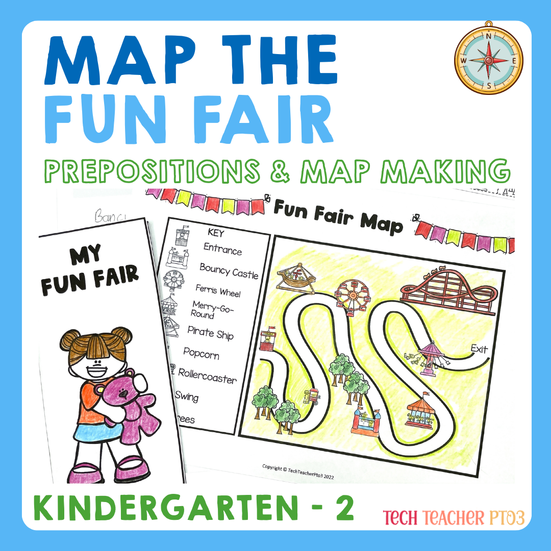
• Geographic features cards (natural and built environments)
• Bird’s-eye view mapping explanation
• Map key and cardinal directions activities
• Fun Fair map worksheet to identify and record geographic features
• Ordinal directions writing activity, locating the toilet/bathroom on the map
• Two wording options included: “toilet block” or “bathroom”
• Student Fun Fair brochure activity where students design their own map with a key and directions
• 10-slide PowerPoint lesson to guide the whole-class activity
Skills Covered
- Map reading
- Map creation
- Cardinal directions (north, south, east, west)
- Ordinal directions
- Bird’s-eye view mapping
- Natural vs built environments
- Spatial awareness
Fun Fair Map Activity | Geography Mapping Skills Cardinal Directions K-2
File Info
PDF & PowerPoint 36 pages zipped file
ACARA Alignment
HASS Geography
AC9HSFK03 – Features of familiar places, why some places are special, and how places can be cared for.
AC9HS1K03 – The natural, managed and constructed features of places, and how places can be represented.
AC9HS2K03 – How places can be spatially represented at different scales and how people are connected to places.
AC9HS2S03 – Interpret information from observations and visual sources such as maps.